Manaslu Circuit Trek Map

25th Jun, 2024
Manaslu Circuit Trek Map: Your Ultimate Guide by Actual Adventure
Welcome to Actual Adventure's comprehensive Manaslu Circuit Trek Map page. Our map is designed to enhance your trekking experience with quality-assured, updated, and reliable information. Featuring essential functionalities such as zoom in and zoom out, our map ensures simplicity and practicality for all trekkers.
Table of Contents
Features of the Manaslu Circuit Trek Map
Our map accurately portrays the trails of the Manaslu region along with other geographical features such as glaciers, peaks, rivers, and religious sites. This map is an indispensable tool for accessing trek information and details.
The map uses a standard set of icons and symbols, which are graphical depictions of various features, including:
- National Park Boundary
- Highway
- Main Road
- Main Trekking Route ( blue line )
- Secondary Trekking Route
- Peaks
- Temple
- Monastery
- Glacier (blue water)
- Rivers
- Check Points
- Campsites
- World Heritage Sites
- Bridges
Why Trek the Manaslu Circuit?
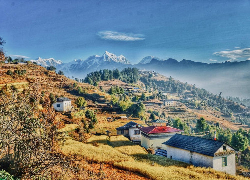
The Manaslu Circuit Trek is renowned for its picturesque lowland valleys, rich mountain cultures, ancient monasteries, and challenging mountain passes. Unlike the crowded trails of Everest and Annapurna, the Manaslu region offers a less-trodden path through mystical valleys and glaciers, providing both challenge and exhilaration.
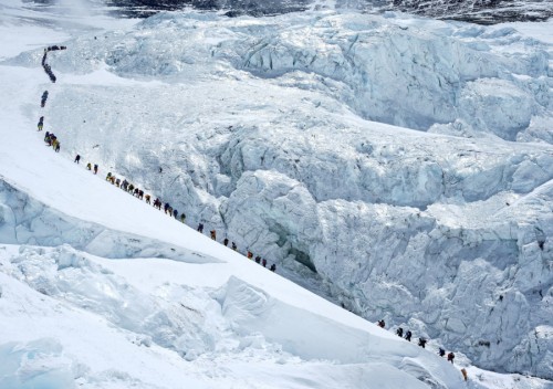
Larkya La Pass (one of the highest trekking passes at 5,106 meters) is a stunning highlight of the Manaslu Circuit. Additionally, the Tsum Valley, Budi Gandaki Valley, Nubri Valley, and Marshyangdi Valley are notable attractions. The trek includes crossing high passes along the Tibet border, hiking to Manaslu Base Camp, and side hikes to Birendra Lake (3620m) and Kalchuman Lake (3800m). Spectacular views of Mt. Manaslu (the 8th highest peak in the world), Mt. Ganesh, Mt. Sringi, and Mt. Boudha ranges are a major draw for trekkers.
Accessing the Manaslu Circuit
To begin your trek, you must drive from Kathmandu or Pokhara to Soti Khola or Barpak as there are no direct flights to the Manaslu and Tsum Valley regions. Unlike the Everest, Annapurna, and Langtang regions, treks in the Manaslu region must be organized through local tour operators. Actual Adventure offers a 14-day Manaslu trek from Kathmandu, allowing you to explore the hidden valleys and tucked-away gompas of the Manaslu region.
Using the Manaslu Circuit Trek Map
The map features:
- Glaciers (blue water)
- Conservation Areas
- Main Trekking Trail (blue line)
- Popular landmarks and stopping points in highlighted-bold letters
- Symbols for peaks, campsites, temples, monasteries, World Heritage Sites, rivers, and bridges
Notable Highlights
- Larkya La Pass (5106 meters): The highest and most thrilling pass in the Manaslu region.
- Tsum Valley: A hidden gem with rich culture and stunning landscapes.
- Birendra Lake : Beautiful side hikes offering serene natural beauty.
- Valleys: Tsum, Budi Gandaki, Nubri, and Marshyangdi.
- Peaks: Mt. Manaslu, Mt. Ganesh, Mt. Sringi, and Mt. Boudha ranges.
For a detailed trekking itinerary and to plan your adventure, visit Actual Adventure. Our expert guides and comprehensive services ensure a memorable and safe trekking experience.

Recent Posts

8th Feb, 2026

6th Feb, 2026